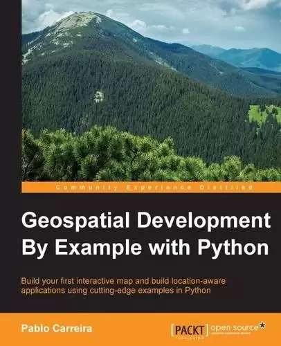
Book Description
Key Features
- Learn the full geo-processing workflow using Python with open source packages
- Create press-quality styled maps and data visualization with high-level and reusable code
- Process massive datasets efficiently using parallel processing
Book Description
From Python programming good practices to the advanced use of analysis packages, this book teaches you how to write applications that will perform complex geoprocessing tasks that can be replicated and reused.
Much more than simple scripts, you will write functions to import data, create Python classes that represent your features, and learn how to combine and filter them.
With pluggable mechanisms, you will learn how to visualize data and the results of analysis in beautiful maps that can be batch-generated and embedded into documents or web pages.
Finally, you will learn how to consume and process an enormous amount of data very efficiently by using advanced tools and modern computers’ parallel processing capabilities.
What you will learn
- Prepare a development environment with all the tools needed for geo-processing with Python
- Import point data and structure an application using Python’s resources
- Combine point data from multiple sources, creating intuitive and functional representations of geographic objects
- Filter data by coordinates or attributes easily using pure Python
- Make press-quality and replicable maps from any data
- Download, transform, and use remote sensing data in your maps
- Make calculations to extract information from raster data and show the results on beautiful maps
- Handle massive amounts of data with advanced processing techniques
- Process huge satellite images in an efficient way
- Optimize geo-processing times with parallel processing
About the Author
Pablo Carreira is a Python programmer and a full stack developer living in Sao Paulo state, Brazil. He is now the lead developer of an advanced web platform for precision agriculture and actively uses Python as a backend solution for efficient geoprocessing.
Born in 1980, Brazil, Pablo graduated as an agronomical engineer. Being a programming enthusiast and self-taught since childhood, he learned programming as a hobby and later honored his techniques in order to solve work tasks.
Having 8 years of professional experience in geoprocessing, he uses Python along with geographic information systems in order to automate processes and solve problems related to precision agriculture, environmental analysis, and land division.
Table of Contents
Chapter 1. Preparing the Work Environment
Chapter 2. The Geocaching App
Chapter 3. Combining Multiple Data Sources
Chapter 4. Improving the App Search Capabilities
Chapter 5. Making Maps
Chapter 6. Working with Remote Sensing Images
Chapter 7. Extract Information from Raster Data
Chapter 8. Data Miner App
Chapter 9. Processing Big Images
Chapter 10. Parallel Processing
中文:
书名:Geospatial Development By Example with Python
Key Features
- 通过开放源码包使用Python了解完整的地理处理工作流
- 使用高级且可重复使用的代码创建媒体质量的样式地图和数据可视化
- 使用并行处理高效处理海量数据集
Book Description
从Python编程的良好实践到分析包的高级使用,本书教您如何编写执行可复制和重复使用的复杂地理处理任务的应用程序。
除了简单的脚本,您还将编写函数来导入数据,创建表示您的特性的Python类,并学习如何组合和过滤它们。
通过可插拔机制,您将学习如何在漂亮的地图中可视化数据和分析结果,这些地图可以批量生成并嵌入到文档或网页中。
最后,您将学习如何使用先进的工具和现代计算机的并行处理能力非常高效地使用和处理海量数据。
你将学到什么
- 准备一个开发环境,其中包含使用Python进行地理处理所需的所有工具
- 使用Python的资源导入点数据和构建应用程序
- 组合来自多个源的点数据,创建地理对象的直观和功能表示
- 使用纯Python轻松按坐标或属性过滤数据
- 根据任何数据制作印刷质量且可复制的地图
- 下载、转换和使用地图中的遥感数据
- 进行计算以从栅格数据中提取信息并在漂亮的地图上显示结果
- 使用先进的处理技术处理海量数据
- 以高效的方式处理巨大的卫星图像
- 通过并行处理优化地理处理时间
关于作者
Pablo Carreira 是居住在巴西圣保罗州的一名Python程序员和全栈开发人员。他现在是精准农业高级网络平台的首席开发人员,并积极使用Python作为高效地理处理的后端解决方案。
巴勃罗1980年出生于巴西,毕业时是一名农艺工程师。作为一名编程爱好者,从小自学成才,他把编程作为一种爱好来学习,后来为了解决工作任务而尊重自己的技术。
他在地理处理方面有8年的专业经验,他将Python与地理信息系统结合使用,以实现流程自动化,并解决与精准农业、环境分析和土地分割相关的问题。
目录表
第1章:准备工作环境
Chapter 2. The Geocaching App
第3章.组合多个数据源
Chapter 4. Improving the App Search Capabilities
第五章.制作地图
第6章.使用遥感图像
第7章.从栅格数据中提取信息
第8章Data Miner应用程序
第9章.处理大图像
Chapter 10. Parallel Processing
评论前必须登录!
注册