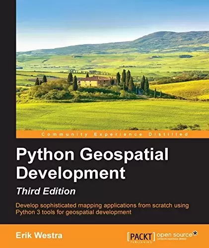
Book Description
Key Features
- Build web applications based around maps and geospatial data using Python 3.x
- Install and use various toolkits and obtain geospatial data for use in your programs
- This practical, hands-on book will teach you all about geospatial development in Python
Book Description
Geospatial development links your data to locations on the surface of the Earth. Writing geospatial programs involves tasks such as grouping data by location, storing and analyzing large amounts of spatial information, performing complex geospatial calculations, and drawing colorful interactive maps. In order to do this well, you’ll need appropriate tools and techniques, as well as a thorough understanding of geospatial concepts such as map projections, datums, and coordinate systems.
This book provides an overview of the major geospatial concepts, data sources, and toolkits. It starts by showing you how to store and access spatial data using Python, how to perform a range of spatial calculations, and how to store spatial data in a database. Further on, the book teaches you how to build your own slippy map interface within a web application, and finishes with the detailed construction of a geospatial data editor using the GeoDjango framework.
By the end of this book, you will be able to confidently use Python to write your own geospatial applications ranging from quick, one-off utilities to sophisticated web-based applications using maps and other geospatial data.
What you will learn
- Access, manipulate, and display geospatial data from within your Python programs
- Master the core geospatial concepts of location, distance, units, projections, and datums
- Read and write geospatial data in both vector and raster format
- Perform complex, real-world geospatial calculations using Python
- Store and access geospatial information in a database
- Use points, lines, and polygons within your Python programs
- Convert geospatial data into attractive maps using Python-based tools
- Build complete web-based mapping applications using Python
About the Author
Erik Westra has been a professional software developer for over 25 years and has worked almost exclusively in Python for the past decade. Erik’s early interest in graphical user interface design led to the development of one of the most advanced urgent courier dispatch systems used by messenger and courier companies worldwide. In recent years, Erik has been involved in the design and implementation of systems matching seekers and providers of goods and services across a range of geographical areas as well as real-time messaging and payments systems. This work has included the creation of real-time geocoders and map-based views of constantly changing data. Erik is based in New Zealand, and he works for companies worldwide.
He is also the author of the Packt titles Python Geospatial Analysis and Building Mapping Applications with QGIS as well as the forthcoming title Modular Programming with Python.
Table of Contents
Chapter 1. Geospatial Development Using Python
Chapter 2. GIS
Chapter 3. Python Libraries for Geospatial Development
Chapter 4. Sources of Geospatial Data
Chapter 5. Working with Geospatial Data in Python
Chapter 6. Spatial Databases
Chapter 7. Using Python and Mapnik to Generate Maps
Chapter 8. Working with Spatial Data
Chapter 9. Improving the DISTAL Application
Chapter 10. Tools for Web-based Geospatial Development
Chapter 11. Putting It All Together – a Complete Mapping System
Chapter 12. ShapeEditor – Importing and Exporting Shapefiles
Chapter 13. ShapeEditor – Selecting and Editing Features
中文:
书名:Python Geospatial Development, 3rd Edition
Key Features
- 使用Python3.x构建基于地图和地理空间数据的Web应用程序
- 安装和使用各种工具包并获取在程序中使用的地理空间数据
- 这本实用的实践性书籍将向您传授有关使用Python进行地理空间开发的所有知识
图书描述
地理空间开发将您的数据链接到地球表面上的位置。编写地理空间程序涉及按位置对数据进行分组、存储和分析大量空间信息、执行复杂的地理空间计算以及绘制彩色交互式地图等任务。为了做好这项工作,您将需要适当的工具和技术,以及对地图投影、基准和坐标系等地理空间概念的透彻理解。
本书概述了主要的地理空间概念、数据源和工具包。它首先向您展示如何使用Python存储和访问空间数据、如何执行一系列空间计算以及如何在数据库中存储空间数据。此外,本书还将教您如何在Web应用程序中构建自己的地图界面,并详细介绍如何使用GeoDjango框架构建地理空间数据编辑器。
到本书结束时,您将能够自信地使用Python编写自己的地理空间应用程序,从快速、一次性的实用程序到使用地图和其他地理空间数据的复杂的基于Web的应用程序。
你将学到什么
- 从您的Python程序中访问、操作和显示地理空间数据
- 掌握位置、距离、单位、投影和基准面等核心地理空间概念
- Read and write geospatial data in both vector and raster format
- 使用Python执行复杂的真实地理空间计算
- Store and access geospatial information in a database
- 在您的Python程序中使用点、线和面
- 使用基于Python的工具将地理空间数据转换为有吸引力的地图
- 使用Python构建完整的基于Web的制图应用程序
关于作者
Erik Westra 作为一名专业软件开发人员已有超过25年的经验,在过去的十年中,他几乎只在Python中工作。埃里克对图形用户界面设计的早期兴趣导致了全球信使和快递公司使用的最先进的紧急快递调度系统之一的开发。近年来,Erik参与了一系列地理区域内搜索者与商品和服务提供商的匹配系统的设计和实施,以及实时信息和支付系统的设计和实施。这项工作包括为不断变化的数据创建实时地理编码器和基于地图的视图。埃里克常驻新西兰,在世界各地的公司工作。
他也是Packt书目的作者,《使用QGIS进行的Python地理空间分析和建筑地图应用程序》以及即将出版的《用Python进行模块化编程》。
目录表
第1章:使用Python进行地理空间开发
Chapter 2. GIS
Chapter 3. Python Libraries for Geospatial Development
第四章地理空间数据的来源
第5章.在Python中使用地理空间数据
第六章.空间数据库
第7章.使用Python和Mapnik生成地图
Chapter 8. Working with Spatial Data
第9章:改进远端应用程序
第10章:基于Web的地理空间开发工具
第11章–完整的地图绘制系统
第12章ShapeEditor-导入和导出shapefile
第13章ShapeEditor-选择和编辑要素
评论前必须登录!
注册