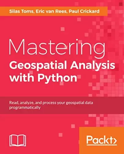
Book Description
Explore GIS processing and learn to work with various tools and libraries in Python
Key Features
- Read, analyze, and present geospatial data programmatically
- Understand the powerful geoprocessing tools of Python
- Automate your Geospatial workflows using Python
Book Description
Python comes with a host of open source libraries and tools that help you work on professional geoprocessing tasks without investing in expensive tools. This book will introduce Python developers, both new and experienced, to a variety of new code libraries that have been developed to perform geospatial analysis, statistical analysis, and data management. As geospatial programming is a specialized subset of Python programming, this book will use examples and code snippets that will help explain how Python 3 differs from Python 2, and how these new code libraries can be used to solve age-old problems in geospatial analysis.
You will begin by understanding what geoprocessing is and explore the tools and libraries that Python 3 offers. You will then learn to use Python code libraries to read and write geospatial data. From here, you will move on to working with rasters and vector analysis. You will then learn to perform geospatial queries within databases and learn PyQGIS to automate analysis within the QGIS mapping suite. Moving forward, you will explore the newly released ArcGIS API for Python and ArcGIS Online to perform geospatial analysis and create ArcGIS Online web maps. Further, you will deep dive into Python Geospatial web frameworks and learn to create a geospatial REST API. In the last module, you will work with machine learning Python libraries and also perform geospatial analysis using distributed servers.
What you will learn
- Manage code libraries and abstract geospatial analysis techniques using Python 3.
- Explore popular code libraries that perform specific tasks for geospatial analysis.
- Utilize these libraries for data conversion, data management, web map and REST API creation.
- Learn techniques related to processing geospatial data in the cloud.
- Leverage features of Python 3 with geospatial databases such as PostGIS, SQL Server, and Spatialite.
- Explore the use of machine learning and cluster computing with geospatial data..
Who This Book Is For
The audience for this book includes students, developers, and geospatial professionals who need a reference book that covers GIS data management, analysis, and automation techniques with code libraries built in Python 3.
Table of Contents
Chapter 1. Package Installation and Management
Chapter 2. Introduction to Geospatial Code Libraries
Chapter 3. Introduction to Geospatial Databases
Chapter 4. Data Types, Storage, and Conversion
Chapter 5. Vector Data Analysis
Chapter 6. Raster Data Processing
Chapter 7. Geoprocessing with Geodatabases
Chapter 8. Automating QGIS Analysis
Chapter 9. ArcGIS API for Python and ArcGIS Online
Chapter 10. Geoprocessing with a GPU Database
Chapter 11. Flask and GeoAlchemy2
Chapter 12. GeoDjango
Chapter 13. Geospatial REST API
Chapter 14. Cloud Geodatabase Analysis and Visualization
Chapter 15. Automating Cloud Cartography
Chapter 16. Python Geoprocessing with Hadoop
中文:
书名:Mastering Geospatial Analysis with Python
探索GIS处理过程,并学习如何在Python中使用各种工具和库
Key Features
- Read, analyze, and present geospatial data programmatically
- 了解Python强大的地理处理工具
- Automate your Geospatial workflows using Python
图书描述
Python附带了大量开源库和工具,可以帮助您处理专业的地理处理任务,而无需投资昂贵的工具。本书将向新手和有经验的开发人员介绍各种新的代码库,这些代码库是为执行地理空间分析、统计分析和数据管理而开发的。由于地理空间编程是Python编程的一个专门子集,本书将使用示例和代码片段来帮助解释Python3与Python2的不同之处,以及如何使用这些新代码库来解决地理空间分析中的古老问题。
您将从了解什么是地理处理开始,并探索Python3提供的工具和库。然后,您将学习使用Python代码库来读写地理空间数据。从这里开始,您将继续使用栅格和矢量分析。然后,您将学习如何在数据库中执行地理空间查询,并学习如何在QGIS制图套件中自动执行分析。接下来,您将浏览新发布的ArcGIS API for Python和ArcGIS Online,以执行地理空间分析并创建ArcGIS Online Web地图。此外,您还将深入研究Python地理空间Web框架,并学习如何创建地理空间REST API。在最后一个模块中,您将使用机器学习的Python库,并使用分布式服务器执行地理空间分析。
你将学到什么
- 使用Python3管理代码库和抽象地理空间分析技术。
- 浏览为地理空间分析执行特定任务的常用代码库。
- 利用这些库进行数据转换、数据管理、Web地图和REST API创建。
- 学习与在云中处理地理空间数据相关的技术。
- 在地理空间数据库(如PostGIS、SQL Server和Spatialite)中利用Python3的功能。
- 探索使用机器学习和集群计算处理地理空间数据。
这本书是为谁写的
本书的读者包括学生、开发人员和地理空间专业人员,他们需要一本涵盖使用Python3构建的代码库的GIS数据管理、分析和自动化技术的参考书。
目录表
Chapter 1. Package Installation and Management
第2章地理空间代码库简介
第三章地理空间数据库简介
Chapter 4. Data Types, Storage, and Conversion
第5章.矢量数据分析
第6章.栅格数据处理
Chapter 7. Geoprocessing with Geodatabases
第8章:自动执行QGIS分析
第9章.ArcGIS API for Python和ArcGIS Online
Chapter 10. Geoprocessing with a GPU Database
第11章.烧瓶和地炼术2
第12章.GeoDjango
第13章.地理空间REST API
第14章云地理数据库分析和可视化
Chapter 15. Automating Cloud Cartography
Chapter 16. Python Geoprocessing with Hadoop
评论前必须登录!
注册