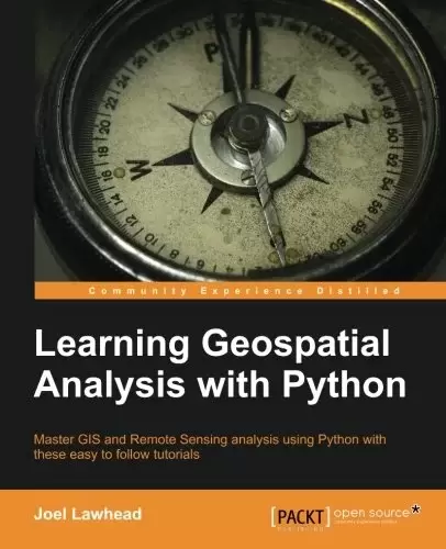
Book Description
Master GIS and Remote Sensing analysis using Python with these easy to follow tutorials
Overview
- Construct applications for GIS development by exploiting Python
- Focuses on built-in Python modules and libraries compatible with the Python Packaging Index distribution system- no compiling of C libraries necessary
- This is a practical, hands-on tutorial that teaches you all about Geospatial analysis in Python
In Detail
Geospatial analysis is used in almost every field you can think of from medicine, to defense, to farming. It is an approach to use statistical analysis and other informational engineering to data which has a geographical or geospatial aspect. And this typically involves applications capable of geospatial display and processing to get a compiled and useful data.
“Learning Geospatial Analysis with Python” uses the expressive and powerful Python programming language to guide you through geographic information systems, remote sensing, topography, and more. It explains how to use a framework in order to approach Geospatial analysis effectively, but on your own terms.
“Learning Geospatial Analysis with Python” starts with a background of the field, a survey of the techniques and technology used, and then splits the field into its component speciality areas: GIS, remote sensing, elevation data, advanced modelling, and real-time data.
This book will teach you everything there is to know, from using a particular software package or API to using generic algorithms that can be applied to Geospatial analysis. This book focuses on pure Python whenever possible to minimize compiling platform-dependent binaries, so that you don’t become bogged down in just getting ready to do analysis.
“Learning Geospatial Analysis with Python” will round out your technical library with handy recipes and a good understanding of a field that supplements many a modern day human endeavors.
What you will learn from this book
- Automate Geospatial analysis workflows using Python
- Code the simplest possible GIS in 60 lines of Python
- Mold thematic maps with Python tools
- Get a hold of the various forms the geospatial data comes in
- Produce elevation contours using Python tools
- Create flood inundation models
- Learn Real-Time Data tracking and apply it in storm chasing
Approach
This is a tutorial-style book that helps you to perform Geospatial and GIS analysis with Python and its tools/libraries. This book will first introduce various Python-related tools/packages in the initial chapters before moving towards practical usage, examples, and implementation in specialized kinds of Geospatial data analysis.
Who this book is written for
This book is for anyone who wants to understand digital mapping and analysis and who uses Python or another scripting language for automation or crunching data manually.This book primarily targets Python developers, researchers, and analysts who want to perform Geospatial, modeling, and GIS analysis with Python.
Table of Contents
Chapter 1: Learning Geospatial Analysis with Python
Chapter 2: Geospatial Data
Chapter 3: The Geospatial Technology Landscape
Chapter 4: Geospatial Python Toolbox
Chapter 5: Python and Geographic Information Systems
Chapter 6: Python and Remote Sensing
Chapter 7: Python and Elevation Data
Chapter 8: Advanced Geospatial Python Modelling
Chapter 9: Real-Time Data
Chapter 10: Putting It All Together
中文:
书名:使用Python学习地理空间分析
通过这些简单易懂的教程,掌握使用Python进行的GIS和遥感分析
概述
- 利用Python构建地理信息系统开发应用程序
- 重点介绍与Python打包索引分发系统兼容的内置Python模块和库–无需编译C库
- 这是一个实用的动手教程,教您有关使用Python进行地理空间分析的所有知识
详细地说
地理空间分析几乎用于你能想到的每一个领域,从医学到国防,再到农业。它是一种对具有地理或地理空间方面的数据使用统计分析和其他信息工程的方法。这通常涉及能够进行地理空间显示和处理以获得经过编译的有用数据的应用程序。
使用Python学习地理空间分析使用富有表现力且功能强大的Python编程语言来指导您学习地理信息系统、遥感、地形等。它解释了如何使用框架来有效地进行地理空间分析,但要由您自己决定。
使用Python学习地理空间分析从该领域的背景开始,对所使用的技术和技术进行调查,然后将该领域划分为其组成部分的专业领域:地理信息系统、遥感、高程数据、高级建模和实时数据。
这本书将教你所有要知道的东西,从使用特定的软件包或API到使用可以应用于地理空间分析的通用算法。这本书尽可能地关注纯Python,以尽量减少编译与平台相关的二进制代码,这样您就不会陷入仅仅准备进行分析的泥潭。
使用Python学习地理空间分析将使您的技术库更加完善,包括方便的食谱和对一个补充了许多现代人类工作的领域的良好理解。
What you will learn from this book
- Automate Geospatial analysis workflows using Python
- 用60行Python语言编写最简单的地理信息系统
- Mold thematic maps with Python tools
- 了解地理空间数据的各种形式
- Produce elevation contours using Python tools
- Create flood inundation models
- 学习实时数据跟踪并将其应用于风暴追逐
方法
这是一本教程风格的书,帮助您使用Python及其工具/库执行地理空间和地理信息系统分析。本书将首先在最初的章节中介绍各种与Python相关的工具/包,然后介绍在特定类型的地理空间数据分析中的实际用法、示例和实现。
Who this book is written for
本书面向希望了解数字地图和分析,并使用Python或其他脚本语言进行自动化或手动处理数据的任何人。本书主要面向希望使用Python执行地理空间、建模和地理信息系统分析的Python开发人员、研究人员和分析人员。
Table of Contents
Chapter 1: Learning Geospatial Analysis with Python
Chapter 2: Geospatial Data
Chapter 3: The Geospatial Technology Landscape
Chapter 4: Geospatial Python Toolbox
第5章:Python和地理信息系统
Chapter 6: Python and Remote Sensing
Chapter 7: Python and Elevation Data
Chapter 8: Advanced Geospatial Python Modelling
Chapter 9: Real-Time Data
Chapter 10: Putting It All Together
评论前必须登录!
注册