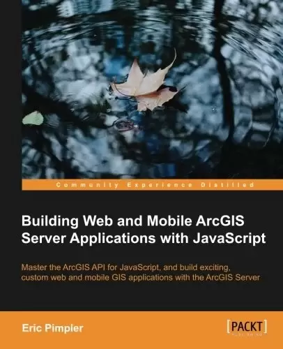
Book Description
Master the ArcGIS API for JavaScript, and build exciting, custom web and mobile GIS applications with the ArcGIS Server
Overview
- Develop ArcGIS Server applications with JavaScript, both for traditional web browsers as well as the mobile platform
- Acquire in-demand GIS skills sought by many employers
- Step-by-step instructions, examples, and hands-on practice designed to help you learn the key features and design considerations for building custom ArcGIS Server applications
In Detail
ArcGIS Server is the leading software for developing both web and mobile GIS applications. There are a number of programming languages that you can use to develop applications with ArcGIS Server including JavaScript, Flex, and Silverlight. However, the ArcGIS API for JavaScript is the preferred way of developing your custom applications for ArcGIS Server since it can be used for both web and mobile application development. It’s easy to use and doesn’t require the use of a browser plugin.
This tutorial-based guide provides you with hands-on experience in developing custom web and mobile ArcGIS Server applications with step-by-step style exercises. Along with introducing you to the HTML/CSS/JavaScript technology stack, you will learn to add intuitive geographic layers of information to your map, interactive query and display of spatial data, add user interface widgets, access geoprocessing tasks, and many more in your own web and mobile GIS applications.
With this practical, hands-on guide, you will be able to develop fully-functional online GIS applications with ArcGIS Server using the ArcGIS API for JavaScript. After creating your own map, you will explore how to add geographic layers from a variety of sources including tiled and dynamic map services, add graphics to the map, and stream geographic features to the browser using a FeatureLayer.
Most applications include the specific functionalities implemented by ArcGIS Server as tasks. You’ll learn how to use the various tasks provided by ArcGIS Server including spatial and attribute queries, identification of features, finding features by attribute, and more. Geocoding and geoprocessing tasks are covered in-depth to help you accomplish your task in GIS. Finally, you’ll learn just how easy it is to integrate ArcGIS.com content into your custom developed applications.
This comprehensive guide quickly advances through probing programmatic techniques for building web and mobile GIS applications which will make application development a lot easier!
What you will learn from this book
- Create maps on a web page and add dynamic and tiled layers
- Add graphics to maps
- Use feature layers to render features in the browser
- Incorporate widgets and toolbars that provide specific functionality to your application
- Perform spatial and attribute queries
- Access geoprocessing tasks including models
- Geocode and reverse geocode addresses
- Develop mobile GIS applications
- Conduct network analysis
Approach
An easy to follow tutorial, this book uses a step-by-step approach with exercises designed to give you hands-on experience with this technology.
Who this book is written for
If you are a web or mobile application developer, who wants to create GIS applications in your respective platform, this book is ideal for you. You will need Java Script programming experience to get the most out of this book. Although designed as an introductory to intermediate level book, it will also be useful for more advanced developers who are new to the topic of developing applications with ArcGIS Server.
Table of Contents
Chapter 1: Introduction to HTML, CSS, and JavaScript
Chapter 2: Creating Maps and Adding Layers
Chapter 3: Adding Graphics to the Map
Chapter 4: The Feature Layer
Chapter 5: Using Widgets and Toolbars
Chapter 6: Performing Spatial and Attribute Queries
Chapter 7: Identifying and Finding Features
Chapter 8: Turning Addresses into Points and Points into Addresses
Chapter 9: Network Analyst Tasks
Chapter 10: Geoprocessing Tasks
Chapter 11: Integration with ArcGIS Online
Chapter 12: Creating Mobile Applications
Appendix: Application Design with ArcGIS Templates and Dojo
中文:
书名:Building Web and Mobile ArcGIS Server Applications with JavaScript
掌握ArcGIS API for JavaScript,并使用ArcGIS Server构建激动人心的自定义Web和移动GIS应用程序
Overview
- 使用JavaScript开发ArcGIS Server应用程序,既适用于传统Web浏览器,也适用于移动平台
- Acquire in-demand GIS skills sought by many employers
- 旨在帮助您了解构建自定义ArcGIS Server应用程序的主要功能和设计注意事项的分步说明、示例和实践
详细地说
ArcGIS Server是开发Web和移动地理信息系统应用程序的领先软件。您可以使用多种编程语言在ArcGIS Server上开发应用程序,包括JavaScript、Flex和Silverlight。但是,ArcGIS API for JavaScript是为ArcGIS Server开发自定义应用程序的首选方式,因为它既可用于Web应用程序开发,也可用于移动应用程序开发。它很容易使用,而且不需要使用浏览器插件。
本基于教程的指南通过分步样式的练习,为您提供了开发自定义Web和移动ArcGIS Server应用程序的实践经验。除了向您介绍HTML/CSS/JavaScript技术堆栈之外,您还将学习如何在您的地图中添加直观的地理信息层、交互查询和显示空间数据、添加用户界面小部件、访问地理处理任务,以及在您自己的Web和移动GIS应用程序中执行更多操作。
有了这本实用的动手指南,您将能够通过ArcGIS Server和ArcGIS API for JavaScript开发功能齐全的在线GIS应用程序。创建您自己的地图后,您将了解如何从各种来源(包括平铺和动态地图服务)添加地理图层、向地图添加图形以及使用FeatureLayer将地理要素流式传输到浏览器。
大多数应用程序都将ArcGIS Server实现的特定功能作为任务包含在内。您将学习如何使用ArcGIS Server提供的各种任务,包括空间和属性查询、识别要素、按属性查找要素等。本课程将深入介绍地理编码和地理处理任务,以帮助您完成在GIS中的任务。最后,您将了解将ArcGIS.com内容集成到定制开发的应用程序中是多么容易。
这本全面的指南通过探索构建Web和移动地理信息系统应用程序的编程技术快速前进,这将使应用程序开发变得更加容易!
What you will learn from this book
- 在网页上创建地图并添加动态和切片图层
- 向地图添加图形
- 使用要素图层在浏览器中渲染要素
- 整合为应用程序提供特定功能的小部件和工具栏
- 执行空间和属性查询
- 访问包括模型在内的地理处理任务
- 对地址进行地理编码和反向地理编码
- Develop mobile GIS applications
- 进行网络分析
方法
作为一个容易遵循的教程,这本书使用了一种循序渐进的方法和练习,旨在让你亲身体验这项技术。
Who this book is written for
如果您是一名Web或移动应用程序开发人员,希望在各自的平台上创建GIS应用程序,这本书是您的理想之选。您需要有Java脚本编程经验才能充分利用本书。虽然它是一本入门到中级的书,但对于不熟悉使用ArcGIS Server开发应用程序这一主题的高级开发人员来说,它也很有用。
目录表
第1章:HTML、CSS和JavaScript简介
第2章:创建地图和添加层
Chapter 3: Adding Graphics to the Map
Chapter 4: The Feature Layer
第5章:使用小部件和工具栏
第6章:执行空间和属性查询
第7章:识别和查找功能
第八章:把地址变成点,把点变成地址
Chapter 9: Network Analyst Tasks
Chapter 10: Geoprocessing Tasks
Chapter 11: Integration with ArcGIS Online
第12章:创建移动应用程序
附录:使用ArcGIS模板和Dojo的应用程序设计
评论前必须登录!
注册